This service does not issue emergency alerts

Official alerts, evacuation orders and emergency instructions come only from your responsible public authority. Call 911 in an emergency.

You are offline. The information below was saved earlier and may be out of date. Connect to refresh

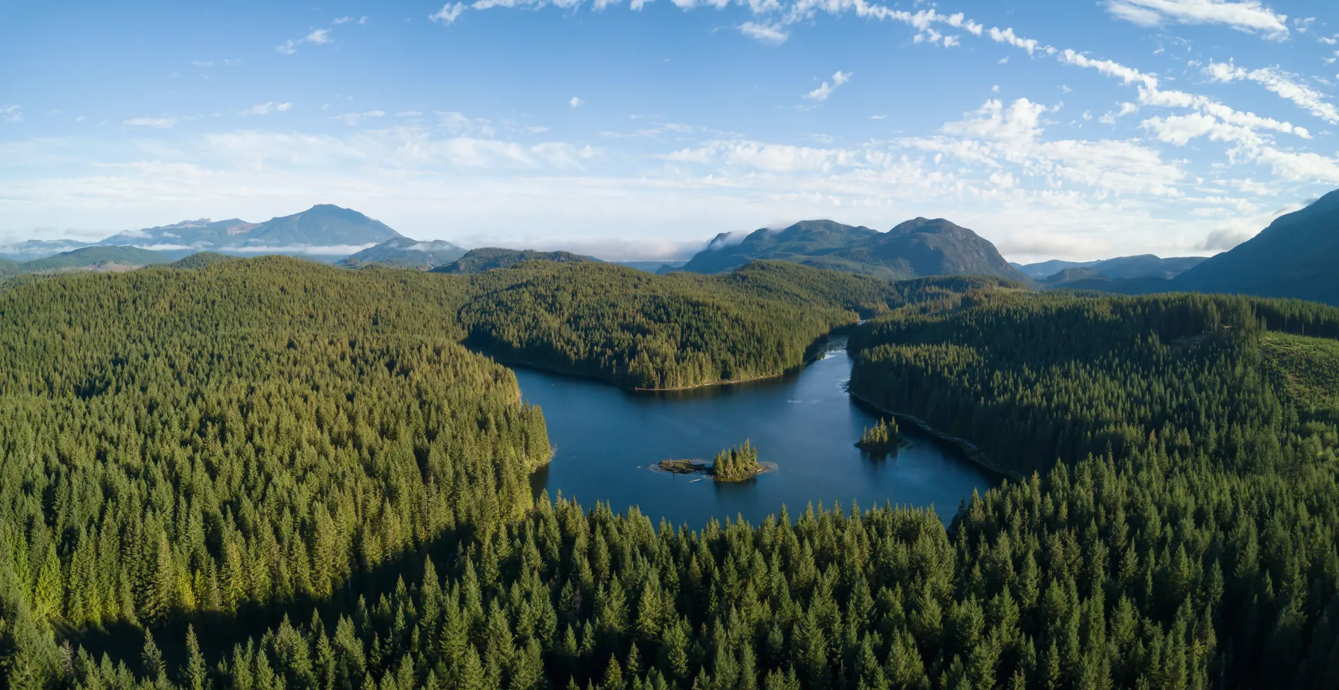
Sunbeams reaching into a forested mountain valley at dawn through low mist.

Wildfire Ahead

The land is the argument.

We help agencies see wildfire risk earlier and understand it better. We do not issue alerts, and we do not decide what happens on a fire.

Mountain valley at dawn — Before

Act I

This is what is at stake

Forest, water, mountain and coast, and the communities inside them. Before any statistic, this is the thing the work is for.

  • The bright turquoise water of Peyto Lake below forested slopes in Banff National Park, Alberta.
    Peyto Lake — Banff National Park
  • A young deer standing alert among the bare trees of a winter forest near Thunder Bay, Ontario.
    Thunder Bay — Ontario
  • Looking up the trunks of tall redwoods in Redwood National and State Parks, California.
    Redwoods — California

Cropped to portrait. The container owns the shape and the photograph fills it, anchored to a curated focal point so the subject survives — a naive centre crop takes the deer's head off.

Act II

This is what happens

The same land, a different day. In Canada, wildfire burned about 2.7 million hectares a year on average between 1994 and 2023 — across roughly 7,000 fires a year.

Spirit Island in Maligne Lake, Jasper National Park, a small stand of conifers ringed by mountains.
Jasper National Park. Maligne Lake, before.
A hiker standing among the blackened standing trunks of a burned forest in Jasper National Park.
Jasper National Park, after the fire. A different place in the same park — not the same view.

Two real places, both in Jasper, each captioned for what it is. We do not compose a before-and-after of one location out of photographs of two.

Plumes of wildfire smoke blowing across a highway, reducing visibility for traffic.
Smoke crossing a highway
~7,000
Wildfires a year in Canada, 1994–2023 average
~2.7M
Hectares burned a year, same period
46%
Of those fires started by lightning
83%
Of the area burned, from those same lightning fires

The last two belong together: the ignitions people cause are far more numerous than the ones that burn the most country. Figures from Natural Resources Canada, Canadian Wildland Fire Information System. A national average hides very large year-to-year and regional variation.

Act III

This is why it is hard

A fire forecast is not a line on a map. It is a spread of possible futures, and the honest way to draw it is as a probability.

  • A forecast is a probability, not a line

    Burn-probability contours are routinely misread as a predicted daily fire boundary. They are not the same thing, and confusing them is dangerous.

  • The data does not agree with itself

    Canada's and the United States' national fire records use different size thresholds, geometries, cause taxonomies and revision policies. We keep each source's own definitions rather than flattening them into one tidy answer.

  • “No fire seen” is not “nobody looked”

    A satellite that saw cloud, or passed at the wrong hour, did not observe an absence of fire. Treating the two as the same is a fast route to a confidently wrong model.

  • Weather drives it, and weather is uncertain

    A wind shift is a fork in the forecast. Showing that spread honestly is more useful to a commander than a single confident answer would be.

Act IV

This is what the platform does

Five products, in plain language — each with the thing it explicitly does not do.

The five products, what each does, and what each explicitly does not do
ProductWhat it doesWhat it does not do
Data foundationBrings decades of scattered fire records into one place without erasing what makes them different.Is not a complete or finished record of every fire.
Forecast engineRuns many possible versions of a fire, not one.Does not predict what will happen.
Command supportPuts the geometry, the trade-offs and the unknowns in front of commanders faster.Does not decide, dispatch or command.
Public informationShows official information from your government, clearly separated from our modelling.Does not issue alerts or evacuation orders.
Drone and sensingSupports agency-flown missions under their own aviation approvals.Does not fly, route or deconflict aircraft.
A single firefighter in protective gear working close to an intense wildfire in backcountry terrain.
Firefighting imagery shows work, not heroics.

Act V

This is honestly where we are

The programme advances one evidence gate at a time. Passing in one region does not authorize use in another.

  1. Phase 0

    Charter and safety case

    In progress

  2. Phase 1

    Historical data foundation

    In progress

  3. Phase 2

    Prevention and situational awareness

    Not started

  4. Phase 3

    Forecasts in shadow evaluation

    Gated

  5. Phase 4

    Supervised decision support

    Gated

  6. Phase 5

    Multi-agency resource coordination

    Gated

  7. Phase 6

    Wider rollout

    Gated

“Gated” means the work is deliberately blocked behind evidence that does not exist yet — not that it is nearly ready. We publish no delivery dates that an approved plan does not already carry.

Act VI

This is how you take part

Six ways in, ordered by how many people can actually do them. None of them makes you a responder, and nothing submitted here reaches an emergency service.

  • Residents and property owners

    Reduce what your own property offers a fire. A printable checklist, with the first five feet around the structure emphasized.

  • Scientists and engineers

    Test us. Public benchmarks, model cards and documented failure cases. This program publishes negative results, not only wins.

  • Agencies and jurisdictions

    Partner on your terms. We integrate with your existing systems of record and never publish a decision.

  • Indigenous Nations and Tribes

    An invitation to co-govern, not a request for data. Terms originate with partner Nations.

  • Data holders

    Utilities, municipalities, land managers and camera-network operators, under formal agreement.

  • Everyone

    Understand it. Learning to read an uncertainty band correctly is a genuine contribution to public safety.

A burned mountain slope where blackened trunks still stand and green new growth is returning at ground level.
Green returning through black trunks. Fire is not the end of a landscape.

Before you go

If you need to know what is happening right now

This page explains the platform. It does not carry live fire, smoke or evacuation information, and it is not an alerting service.

Go to official emergency information

Official wildfire information

These are the authorities that publish wildfire information and issue alerts. Wildfire Ahead is not one of them. In an emergency, follow your responsible public authority.